What causes a low-pressure system to form?

Low-pressure systems, also known as depressions or cyclones, are atmospheric phenomena that dramatically impact the Earth’s weather and ocean conditions, including the creation of waves that surfers ride.
The more we understand how these systems form and evolve, the better we will decode the science behind severe weather and the process through which energy transfers from the atmosphere to the ocean.
So, what is a low-pressure system, and how does it form?
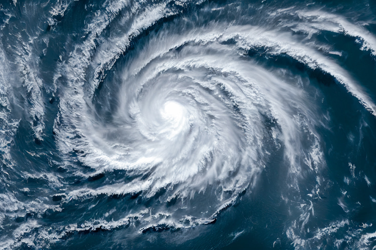
A low-pressure area is essentially a cell of air with a central pressure lower than the surrounding atmosphere.
This pressure difference is what drives the system’s characteristic swirling winds, caused by the Coriolis effect – an apparent force arising from the Earth’s rotation that deflects moving air.
As air flows toward the low-pressure center, the Coriolis effect bends its path, creating a counterclockwise rotation in the Northern Hemisphere and a clockwise rotation in the Southern Hemisphere.
This rotation is essential in generating the wind speeds necessary for wave formation.
The power of a low-pressure system depends on the intensity of the pressure gradient or the rate at which pressure changes across a given distance.
The steeper the gradient, the faster the winds, and consequently, the larger the waves produced as energy transfers from air to water.

How Low-Pressure Systems Begin: The Polar Front
The birthplace of most low-pressure systems is the polar front, a boundary where cold polar air meets warmer air from lower latitudes.
This front exists because of the Earth’s temperature differences, especially prominent in mid-latitudes.
The clash of warm and cold air creates a naturally unstable environment as warm, lighter air flows over the denser, colder air.
This boundary becomes ripe for low-pressure formation when a disturbance or “perturbation” occurs.
Causes for this instability include extreme temperature contrasts, variations in sea surface temperatures, and shifts in the upper atmosphere.
When the conditions align, a phenomenon called baroclinic instability takes place, triggering the development of a low-pressure area.
Baroclinic instability is essentially a pressure and temperature shift over a short distance, disrupting the atmosphere’s balance and initiating the formation of a “wave” along the front.

The Growth of the Cyclone
Once a wave develops along the polar front, warm air begins to rise over the colder air, lowering surface pressure and creating a localized low-pressure cell.
As air rushes toward this area of lower pressure, it continues to spiral due to the Coriolis effect, establishing a cyclonic circulation pattern.
At this stage, the system typically splits into two fronts:
- A warm front, where warm air moves in;
- A cold front, where cooler air follows behind;
The low-pressure cell starts to intensify, pulling in more air from surrounding areas and expanding in size.
This growing vortex of air, if sustained by a steep enough pressure gradient, can become strong enough to generate substantial surface winds.
Between the warm and cold fronts, a warm sector of air forms, where winds blow consistently in the same direction over a stretch of ocean.
This area, combined with intense wind speeds, leads to wave generation.
Surfers and oceanographers often refer to this as the ideal “fetch” zone, where the wind blowing over a long distance creates large waves.

Mature Depressions and Wave Creation
In its fully developed form, a low-pressure system appears on weather maps as tightly packed isobars – lines that connect points of equal pressure.
The closer these lines are, the stronger the pressure gradient and, consequently, the winds.
In these mature systems, winds blow almost parallel to the isobars but spiral slightly inward due to surface friction, creating a distinctive swirling motion.
The fetch zone within the mature low-pressure system is where significant wave generation occurs.
Here, several factors influence wave height:
- Wind Speed: Stronger winds transfer more energy to the ocean surface;
- Fetch Length: The longer the stretch of ocean over which the wind blows, the larger the waves;
- Duration: The longer the wind continues to blow over a particular area, the greater the energy imparted to the water;
Some mature systems create especially powerful waves when they enter dynamic fetch – a state where the system’s movement aligns with the direction of the generated swell, continuously feeding energy into the waves.
Such low-pressure area generate the largest swells, with waves traveling far from the storm’s origin.
Occlusion and Decline
As the low-pressure system continues its journey across the ocean, the cold front eventually catches up with the warm front.
This process forms an occluded front, where warm air is lifted away from the surface, cutting off the system’s fuel source.
Without access to the surface-level temperature contrasts that powered it, the system begins to weaken and lose its characteristic swirling pattern.
In many cases, as a system occludes, it can spawn smaller, secondary cyclones that break off and continue moving.
However, the original low-pressure system will gradually dissipate as the pressure equalizes across the area.

Influence of the Upper Atmosphere
The movement and intensity of low-pressure systems are also shaped by the jet stream, a fast-flowing air current found high in the atmosphere, between 30° and 60° latitude.
The jet stream’s path guides the surface-level movement of depressions, especially if it’s flowing strongly in a certain direction, like from southwest to northeast in the Atlantic.
A strong jet stream provides extra energy to the cyclone, allowing it to deepen and intensify.
Conversely, when the jet stream is weak or split, conditions are less favorable for developing strong low-pressure systems.
This interplay between upper and lower atmospheric layers shows just how interconnected these weather systems are and how various atmospheric layers contribute to their formation and trajectory.


